
Finding Woodbridge Township Streets
A Woodbridge Township street search starts by normalizing the address. Keep the house number, direction, suffix, postal community, ZIP, and any block or lot together. The assessment record gives a parcel starting point. The map then places that parcel on a street segment. A recorded instrument adds a legal description and dated parties. These steps can establish a property trail, but they do not create a list of everyone at an address.
- Enter the address in the county-linked Woodbridge assessment search with Property Location. If the result is uncertain, use Block, Lot, or Qualifier to separate similar parcels.
- Open the Woodbridge GIS Viewer, search the address or place, click the parcel polygon, and note the PAMS PIN or block-and-lot context.
- Use the resulting owner or legal-description information in BrowserView. Check party, town, lot/block, legal-description, date, or book-and-page modes as the record requires.
- For an individual’s own registration question, use the state status portal. It is not a street-by-street voter list and should not be treated as one.
- For an older address association, select a State Library directory volume that actually includes the community, then compare its entry with newspaper, deed, or census evidence.
Use two independent records before treating a historic association as reliable. A parcel identifier and a deed description are stronger together than a name match alone. Note: Street spelling, community labels, and historic Township boundaries can change the address-search path for a record.
Woodbridge Township Parcel Search
The Woodbridge district assessment search is the direct address-keyed entry point. The municipal assessment office is responsible for assessment and appeals. This is a current assessment working file, not a deed-image system and not a resident roll. It is useful for connecting a property location to an owner-search path and parcel identifiers before moving to county records.
| Assessment Field | Input | Use in a Street Search | Important Limit |
|---|---|---|---|
| Property Location | Text | Search a street or address, including suffix variations | Does not identify every occupant |
| Owner Name | Text | Start with a known owner association | Owner is not automatically a resident |
| Block | Numeric or text | Route a local tax-block identifier | Use with other parcel details |
| Lot | Numeric or text | Narrow a parcel within a block | Does not replace legal description |
| Qualifier | Text | Separate condominium or other qualified parcels | Confirm the live record context |
The reviewed interface also has fixed Middlesex County and Woodbridge district context, plus output/list controls. It does not provide a verified ZIP input. A tax-mailing address is where assessment correspondence goes. It may be an office, fiduciary, family contact, or post-office box, so it should never be described as proof of residence.
The assessment search shows the Property Location, Owner Name, Block, Lot, and Qualifier controls used to start a Woodbridge Township street directory trail.
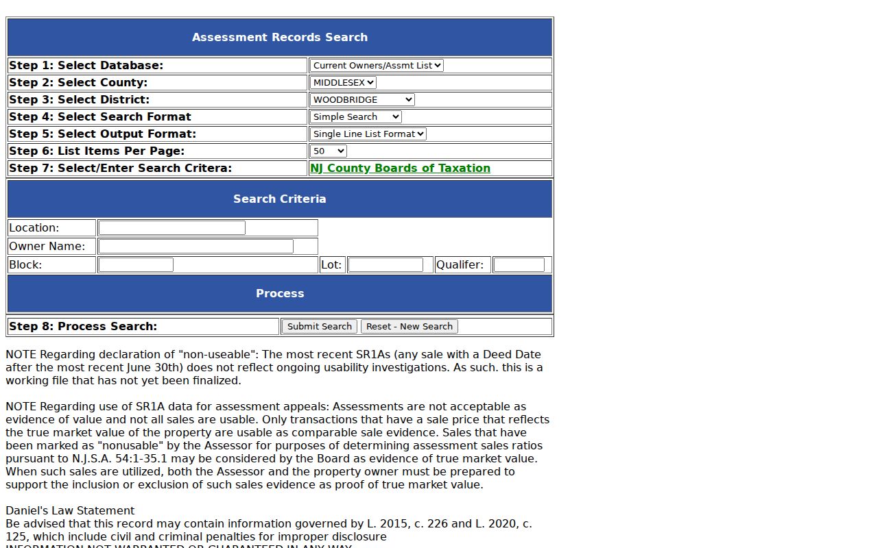
Those fields support parcel navigation first, then a separate check of title records or period sources for the question at hand.
Mapping Woodbridge Township Streets
The Woodbridge GIS Viewer has address/place search, Layer List, Legend, Bookmarks, and Basemap controls. Search the target, click its parcel, then inspect nearby parcel polygons for map context. The underlying parcel service includes PAMS PIN, block, lot, qualifier, situs and owner-mailing field families, plus values and other assessment context. Availability can vary in the live map.
GIS and assessment data complement each other. The map answers where the parcel lies and how it relates spatially to the street. The assessment search routes identifiers and current assessment context. A deed adds recorded parties and a legal description. None of the three is a current household roster, and the map’s displayed limitation says it is graphical rather than a legal survey.
The public configuration has no buffer, radius, measure, select, share, or locate widget. Do not claim a radius search that is not present. For a particular Woodbridge Township street, the defensible method is address search followed by parcel clicks and then record-by-record confirmation.
Township tax maps and county GIS resources provide a second map route, including static sheets and map data. These are map and routing resources. When a boundary decision matters, obtain the appropriate survey or record rather than treating a screen view as conclusive.
| GIS Field Family | Woodbridge Township Street Use |
|---|---|
| PAMS PIN, block, lot, qualifier | Routes the mapped parcel to tax and recorded-document research |
| Property or situs address | Places the parcel on the street and supports address normalization |
| Owner and mailing fields | Provides assessment context, not proof of a current occupant |
| Class, year built, and values | Gives property context that must be read on the current record |
| Geometry and map layers | Shows mapped context, not a legal survey or household relationship |
Note: The GIS inventory came from a non-personal sample, so individual parcel details should be checked in the live map before being quoted.
Woodbridge Township Deed Trails
Middlesex Official Records BrowserView is the county’s public index route for documents along a Woodbridge Township street. Its reviewed modes include party, town, book/page, lot/block, map, and legal-description searching. Use the first instrument found from a parcel trail to capture the recording placement, date, parties, and legal description. Then test the prior grantor as a grantee or follow a recital or book/page reference, while checking that the same property description continues.
The land-records landing page states deeds from 1929 forward, mortgages from 1950 forward, and other documents from 1958 forward. A 2022 county announcement says publicly viewable deed images were extended to 1923. Those are different coverage statements, so confirm the document and image availability in the live result. Earlier deeds are not absent merely because an online search stops; the county recording office and the documented archival microfilm channels are the fallback route.
BrowserView presents the party and parcel-oriented search modes that connect a Woodbridge Township street record to a recorded document.
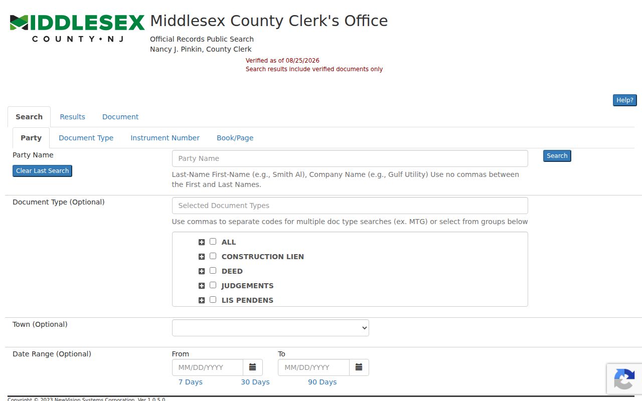
A recorded owner or party establishes a transaction role. It does not establish who was living at the address on the recording date or now.
Woodbridge Township Street Records
Address-keyed sources serve different purposes. The table separates what can be learned from a Woodbridge Township street record from what must remain unclaimed. It also preserves the counter, request, library, and archive routes when a web search cannot supply the needed record.
| Address Source | Keeper | Street Evidence | Access and Boundary |
|---|---|---|---|
| Assessment record | Township assessment office | Location, owner-search identifiers, block and lot context | Current web search; owner or mailing contact is not an occupant |
| Parcel map | Woodbridge GIS | Parcel position, nearby polygons, tax-map context | Public viewer; graphical map, not a legal survey |
| Recorded instruments | County Registry | Parties, date, recording placement, legal description | BrowserView, search room, and copy request; title party is not resident proof |
| Planning or construction file | Woodbridge department custodian | Permit, approval, alteration, or zoning chronology | No public case search found; request a specific address, file type, and dates |
| Historic directory or paper | State Library and Woodbridge Public Library | Period name-and-address association | Coverage differs by volume; historical evidence only |
The Woodbridge Building Department is the municipal contact route for construction context. Where no searchable case system exists, a focused request under the New Jersey Open Public Records Act should name the address, department, file type, and date range. That is more useful than asking for every record connected to a street.
The Registry also has a public search room and written or in-person copy-request channels when a BrowserView result is incomplete or unavailable. The Middlesex Registry FAQ lists certified copies at $2 per page plus a $10 certification charge. Confirm the current fee and submission arrangement with the Registry before payment or a visit.
Woodbridge Township Street Names
Woodbridge Township has ten named communities: Avenel, Colonia, Fords, Hopelawn, Iselin, Keasbey, Menlo Park Terrace, Port Reading, Sewaren, and Woodbridge proper. The community name belongs in an address search because historic directories and newspapers may index the same area by that locality rather than by a modern municipal label. Iselin can appear under Uniontown, Perrytown, or Graham Station in older material.
Historic geography is the local quirk. The Township’s original territory included places now associated with Carteret, Rahway, Edison, Metuchen, and others. Township history explains why an older “Woodbridge” reference can exceed today’s Township boundaries. No official Township-wide street-renumbering year was found. Preserve the locality printed in the source, then compare block, lot, and legal description rather than inventing a conversion year.
Note: A historic locality and a current postal label can both be valid research terms for the same Woodbridge Township street.
Woodbridge Township Street History
For a past address, use the New Jersey State Library directory holdings only after confirming that the volume includes the community. Richmond volumes for 1912 through 1918 explicitly list Woodbridge, Port Reading, Fords, Keasbey, and Sewaren; later volumes change their named coverage. The exact Woodbridge reverse-directory holdings have not been confirmed, so a street-guide or reverse section should be treated as volume-specific, not assumed.
The Woodbridge Public Library Local History route adds digitized newspapers, archives, oral histories, and research assistance. Combine surname, street or community, and a date range. When optical text misses a name, inspect the page image. For older streets, the Library of Congress Woodbridge Sanborn map has two sheets from October 1891. It can show a building and street footprint, not a household.
Historical collections are discussed in greater depth in the Woodbridge Township city directory, while this street directory remains focused on an address-led trail.
Woodbridge Township Record Comparison
Parcel geography, assessment records, and deeds are often confused because they can share an address. They do not prove the same thing. GIS establishes a mapped parcel relationship. Assessment records give current tax-file context and owner search fields. Recorded instruments document a dated transaction and legal description. This comparison matters most when a Woodbridge Township street has multiple units, a qualified parcel, or a mailing address outside the Township.
The county’s Property Fraud Alert offers an owner-controlled, free notification route for new recorded-document matches. Registration can use municipality, block, lot, and party-name variants. It alerts the registrant, but does not prevent fraud, decide a deed’s validity, or replace a title search.
Middlesex Property Fraud Alert shows the county’s record-monitoring route for a Woodbridge Township property.
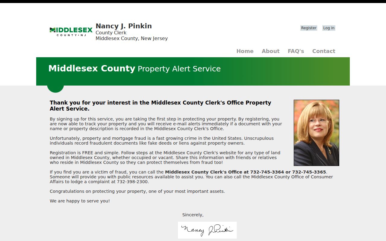
The alert is a notice tool, so an unexpected match still needs review through the Clerk’s actual recorded document.
Woodbridge Township Street Terms
Street records use several terms that sound alike but serve distinct purposes. Keeping them separate helps prevent an assessment search from being mistaken for a title decision or a household list.
- Parcel
- A mapped unit of land in the tax and GIS system, commonly routed by block, lot, and qualifier.
- Situs address
- The physical location of the parcel, which is the appropriate starting key for assessment and mapping work.
- Tax-mailing address
- The contact address for assessment correspondence, which may differ from the parcel location for lawful reasons.
- Legal description
- The recorded property description used to connect title documents more reliably than a house number alone.
- Criss-cross directory
- A period directory arranged by address or street; its coverage must be confirmed in the particular volume.
Block and lot are local tax-map identifiers, while a qualifier distinguishes certain condominium or related parcel records. Record all three when they are available. A house number may change form or be repeated across communities, but the parcel identifiers and legal description provide a stronger bridge among Woodbridge Township street records.
Woodbridge Township Street Limits
No source identified here supplies an open roster of renters, delivery recipients, utility customers, or every household member at a Woodbridge Township address. A property owner may not live on the parcel. A person listed in a deed may be a historic party. Motor-vehicle personal information is restricted under the federal Driver’s Privacy Protection Act, while voter and protected-address material has its own New Jersey limits.
Lawful use. Use Woodbridge Township street records for personal, lawful research, respect protected addresses, and never use an address trail to stalk, harass, or intimidate another person.
The New Jersey Address Confidentiality Program and Daniel’s Law can make an altered or missing address an intentional protection, not an indexing mistake. For a specific record, ask the custodian which rule controls access or redaction.